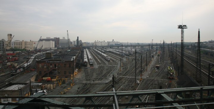
The New York City planning and development world received a jolt of energy in Feburary, when Mayor Bill de Blasio delivered his State of the City address. He announced his intention to redevelop the Sunnyside railyard in western Queens, a 200-acre site, with housing and neighborhood amenities. This announcement quickly met some doubt bothfrom Albany and from various pundits around the city. A complicated mix of layout, soil composition, and land ownership issues will combine to make Sunnyside a difficult project.
But Sunnyside will not be the first place in the city where existing railroad infrastructure makes way for new development. For example, without projects of this scale, Park Avenue would still have train tracks running through it south of 97th Street. We dove into the CHPC archives for some historical perspective on two other ambitious projects of this nature: Lincoln Square and Atlantic Yards.
In the mid-20th Century, the City government was in the midst of widespread slum clearance projects. These planning efforts included areas north and west of Columbus Circle in Manhattan, as well as Fort Greene and its southern reaches in Brooklyn. CHPC archive materials include extensive plans for these sites, including urban renewal area designations from the City Planning Commission; letters in support or opposition to the proposed development; designs and renderings for buildings that never came to fruition; and clippings of press coverage at the time.
An urban development utilizing the air rights over the New York Central Railroad yards between West 59th and West 72nd Streets, the Hudson River and West End Ave, the project called itself Litho Citya name borrowed from the Amalgamated Lithographers Union, which New York Central chose as its development partner. The City Planning Commission found the proposed urban renewal plan for the area to be a substandard and insanitary area and that the proposed redevelopment thereof will eliminate substandard areas. The master plan for Litho City envisioned a terminal axis to the adjacent Lincoln Center, which was a complex of fine architecture and cultural planning isolated in a confused area of depressed neighborhoods and mixed property values. You can read the 1963 master plan below.
Please wait while flipbook is loading. For more related info, FAQs and issues please refer to documentation.
The original 1962 plans called for five components in addition to unspecified improvements to Broadway, Central Park, and Columbus Circle (below):
- 5,300 units of housing in a new neighborhood built on decks above the train tracks. This community would include shopping, schools, community facilities, parks, a marina, hotels, commercial office space, and sufficient parking for all of the cars this development was to bring (the plan makes no mention of access to public transit, but does include a helipad).
- A United World Center to serve as the heart of the community, mostly featuring an international student dormitory and cultural center.
- A new headquarters building for TheNew York Times, as well as a large printing facility nearby, at a space to be called Times Plaza.
- The West Side Drive, to provide access to the waterfront amenities, including a new pier for ocean liners, a marina for pleasure boats, and an extension of Riverside Park.
- Connection to Lincoln Center, which was then under construction, by way of a pedestrian mall raised above 65th Street.
Please wait while flipbook is loading. For more related info, FAQs and issues please refer to documentation.
Of course, this proposal never reached full maturity, as the railroad, the City, and participating organizations teetered on the edge of bankruptcy in the following years. The existing development, Riverside South, is nearly complete as Extell Development works on the final piece of the neighborhood.
The official Fort Greene urban renewal designation, dated 1963, has more detail about the problems of the neighborhood and fewer details about the proposed redevelopment in this key area of Brooklyn than the contemporary plans for Lincoln Square. The City Planning Commissions urban renewal designation report describes the area as characterized by a conglomeration of warehouses, retail stores, manufacturing plants, and old residential structures ranging from well-maintained houses to dilapidated and hazardous buildings. The number of boarded-up structures and vacant residential and commercial units attest to the steady decline of this area over the years. An exterior survey showed that over two-thirds of the structures in the area are in either poor or bad condition. You can read that report below.
Please wait while flipbook is loading. For more related info, FAQs and issues please refer to documentation.
The 1970 redevelopment plans (below) led by the Fort Greene Non-profit Improvement Corporation declared Atlantic Terminal: an urban center for Fort Greene. Its plans boasted:
- New modern housing2,400 apartments for low and moderate income families, 400 of which would be built and operated by NYCHA; the Fort Greene Non-profit Improvement Corporation would build and maintain the remainder. The housing would complement outdoor and indoor recreational facilities, child care and family health centers, convenient shopping.
- An educational complex with facilities for Headstart programs through Senior college. This component of the plan included a new campus for Baruch College to be located over the rail yard where Barclays Center now sits.
- Atlantic Terminal is Community Planned and Community Controlled Urban Renewal, which would insure that when completed
Please wait while flipbook is loading. For more related info, FAQs and issues please refer to documentation.